As most have read, Tropical Storm Fay has impacted Florida far beyond what any of us ever expected. If you have heard about flooding let me put it into perspective: Camelot Elementary was 45 miles from the storm's center when it was nearest us: my lab rain gauges measured 14.75 inches in a 3 1/2 day time period (beginning Wednesday, August 20th at 5:00 pm and ending on Sunday, August 24th at 11:00 am. At one point water flowed between our raised garden beds so quickly that there appeared to be a current! As huge levels filled the St. Johns River, Florida will continue to see flooding. The St. Johns is unique in that it's source is the south central part of our state and it's mouth is in the northeast part of the state - in other words, it flows north. So the impact of the high waters will be felt for the next week or so as the swollen waters flow north through much of our state on it's journey to the Atlantic Ocean.
Of course Tropical Storm Fay just begins our season. We now keep our eyes on the Atlantic and Caribbean for tropical depressions. The latest to strengthen is Tropical Storm Gustav.
A final storm bonus - while standing in the rain Thursday morning helping with bus traffic I found a crayfish crossing the bus loop. He is now in a shallow aquarium living under a rock and has been quite happy eating feeder fish. Every year at this time my students bring me six or seven rescued crayfish. We will see how many are found this year.
THE SUNSHINE SCIENCE CORNER......

It's about sharing the joy of science!!!
Welcome
After spending a year as Florida's Teacher of the Year I am now back in my elementary science lab, weeding my gardens and puting into practice the wonderful things I've learned from the classrooms that I have visited. I hope that I can share those experiences, the neat things we do in my lab, and other ideas I come upon when you visit this site. My hope is that you will find a resource for educators interested in elementary science, young children and good teaching. If you have ideas, a neat project, science news or anything of interest to share, please contact me so it can added it to the site. This isn't about me, it's about all of us; so be a part of our conversation and sharing. So I invite you to check in from time to time and see what's going on!
About Me
- ellenburgra
- I am the elementary science lab teacher for 700 students at Camelot Elementary School. I was the Florida Department of Education/Macy's 2008 Teacher of the Year and travelled the state of Florida visiting classrooms. Now I'm back to my elementary science lab and putting into practice all the wonderful ideas I have seen across Florida.
Search This Blog
Camelot Science Olympiad Team

district competition at UCF
Naked Egg Drop winners

raw eggs were dropped three stories into a container they built - no cracks!
Barge Building competition

Air Rocket demonstrations

air pressure sends rockets into the air over 150 feet!
A Look At Zero Gravity

Showing off my school colors!

A head stand in Zero G

spirals in zero g
An Elementary School Teacher's Short List For Kids
- Any Caldecott or Newberry Award winning book ever written !!!
- Green Eggs and Ham by Dr. Seuss (best book to read aloud to a class)
- Teammates by Peter Golenbock
- The Airplane Alaphabet Book by Jerry Pallotta
- Dem Bones by Bob Barner
- A River Ran Wild by Lynne Cherry
- Curious George by H.A. Rey
- Farewell To Shady Glade by Bill Peet
- The Grouchy Ladybug by Eric Carle
- The Lion's Paw by Robb White ( The Holy Grail - out of print, hard to find, and the best book about Florida ever written for intermediate age kids)
- The Giving Tree by Shel Silverstein
- Harry Potter by J.K. Rowlings ( Every family should read it together)
A Little Humor

A Clean Water Challenge

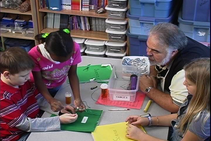
4th Grade students are given the challenge of using the provided tools to clean "dirty water". Coffee grounds, tea leaves, raisins, drops of vinegar and cooking oil are mixed in tap water to provide our water treatment challenge! Tools include a strainer, coffee filters, funnels, cups, paper towels, straws and a spoon.

Organizing a Science Lab


A Cheap Marble Run

Total Pageviews
Camelot Science Club Calendar for the Year
Science Olympiad Club
Meetings will take place on the 2nd and 3rd Monday of every month from 2:45 -4:00 pm
September 21 October 12
October 19 November 9
November 16 December 14
January 11 January 18
February 8 February 15
March 8 March 15
April12 April19
May 10 May 17
State Science Olympiad at UCF: Saturday, May 15, 2010
5th Grade Garden Club
All meeting will take place on Tuesdays from 2:45 -4:00 pm
September 15 September 29
October 13 October 27
November 10 December 1
December 15 January 12
January 26 February 9
February 23 March 9
March 23 April 6
April 20 May 4
May 18 June 1
Aeronautics Club Group A
Meetings will take place on Thursdays from 2:45 -4:00 pm
October 8 November 12
December 10 January 14
February 11 March 11
April 8 May 13
Aeronautics Club Group B
Meetings will take place on Thursdays from 2:45 -4:00 pm
September 24 October 22
November 19 December 17
January 28 February 25
March 25 April 22
May 27
Kid's Corner
Let's start the new school year looking at the weather. In Florida we begin our school year with storms and very rarely with a hurricane. In every area of the country you can find weather that will have an impact on your life, so let's start off this new school year exploring weather!
Did you know that lightning during thunderstorms can cause compass needles on ships to move?
Benjamin Franklin's experiments proved that lightning was electrical and led to his invention of the lightning rod.
What observations can you make that tell you there will be a thunderstorm?
People learn what weather to expect by keeping records of what happened the year(s) before.
So begin the school year by keeping a daily weather record in your science journal - the temperature when you arrive at school amd the amount of daily precipitation.
You can learn about weather map symbols by going to www.hpc.ncep.noaa.gov/html/stationplot.shtml
You can meet meteorologist, Tammy Souza by visiting www.wtsp.com/company/bios/member.aaspx?storyid+92970
Plan A Visit
If you would like to visit our science lab at Camelot just contact me at:
richard.ellenburg@ocps.net or ellenburgra@aol.com
or write:
Rick Ellenburg
c/o Camelot Elementary School
14501 Waterford Chase Parkway
Orlando, Florida 32828
Just let me know what your are interested in (gardens, elementary science labs, specific grades or whatever) and a couple of dates you are interested in. We love visitors.
This Month In Science
Mar. 1, 1872
Yellowstone National Park, the world’s first national park, was established by an act of Congress.
Mar. 3, 1847
Alexander Graham Bell was born
Mar. 5, 1977
Voyage 1, flies past Jupiter
Mar. 11,1867
The volcano Great Mauna Loa erupted in Hawaii
Mar. 14,1794
Eli Whitney patented the cotton gin, which made the mechanical separation of cotton from its seed 50 times faster than doing it by hand.
Mar. 14,1879
Albert Einstein was born
Mar. 16,1926
Dr. Robert Goddard launched a liquid fuel rocket. It rose more than 47 feet and traveled 184 feet in 2.5 seconds.
Mar. 21
Spring begins on this day as the sun crosses the celestial equator. This is called the vernal equinox.
Mar. 24, 1882
Robert Koch announced his discovery of the germs that cause tuberculosis. In 1905 he won a Nobel Prize for his work.
Mar. 25, 1954
RCA manufactured the first color television sets.
Mar. 26, 1953
Dr. Jonas Salk of the University of Pittsburgh announced the discovery of a vaccine against polio.
Mar. 29, 1886
Coca-Cola was invented.

NSTA Science Safety Guidelines in the Classroom
Safety in the science classroom/laboratory requires thorough planning, careful management, and constant monitoring of student activities. Teachers must maintain a safe science program by exercising good judgment, providing proper instruction and supervision, and maintaining a written record of safety instruction. Teachers should be knowledgeable about the properties, possible hazards, and proper use and disposal of all materials used in the classroom. Students are expected to follow all safety procedures and rules in the safety agreement that they sign as well as additional instructions their teachers give them concerning the laboratory activities they perform.
Batteries
· Dispose of batteries that are leaking or corroded.
· Use regular dry cell batteries when teaching concepts
about electrical circuits. Avoid alkaline batteries which
can quickly generate enough heat to cause burns.
Candles (Grades 3-12)
Candles are to be used as instructional tools only!
Candles should be placed on a stable, non-flammable surface, such as a metal jar lid, a metal tray, or a pan of sand.
Students should be cautioned to avoid contact with hot wax.
Students should pin long hair back and avoid wearing loose clothing.
A fire blanket or fire extinguisher should be available.
Elementary students should have adult supervision at all times when working with open flames. (Assign one adult volunteer per group!)
Make sure that flames are extinguished before leaving a lab station. Never leave a burning flame!
Dissection
Dissection of animal specimens is not recommended for elementary students.
Plants are appropriate dissection materials for elementary students.
Preserved specimens should be purchased from a biological supply house.
Rinse specimens before distributing them to the students.
Dissections should be done only in well-ventilated rooms.
Gloves, goggles, and aprons should be worn at all times.
All equipment and lab surfaces must be disinfected, and students should be cautioned against touching their faces with contaminated gloves.
Instruct students in the safe use of dissecting tools before the dissection begins.
Dissecting scissors are the recommended tool for middle school; scalpels and razor blades should not be used.
Dissecting scissors and scalpels are the recommended tools for high school students. Scalpels should be used for incision only.
The most dangerous dissecting tools are those which are dull and therefore require the most force. Only sharp cutting tools should be used.
Special care should be taken to prevent bacterial contamination from unpreserved specimens. Unpreserved specimens should be refrigerated and used within 24 hours.
Remains of specimens should be wrapped in paper or placed in plastic bags and discarded in garbage containers.
Students should wash their hands thoroughly with soap and water, especially under the fingernails, at the end of the laboratory period.
During dissection activities, rinse dissection equipment in a disinfectant at least once a day.
Secure dissecting tools in a locked cabinet when not in use.
NSTA Position Statement - Responsible Use of Live Animals and Dissection in the Science Classroom
Dry Ice
Proper insulating gloves, eye protection, and protective clothing must be worn when handling dry ice.
Always handle dry ice with gloves or tongs – never with bare hands. Dry ice can cause burns.
Do not allow carbon dioxide gas given off by dry ice to accumulate in low areas. The gas is denser than air, and when it accumulates, can cause asphyxiation.
Never place dry ice in a sealed container since the resulting increase in gas pressure may cause an explosion.
Gas Burners (Grades 6-12)
It is important that students be instructed on how to use gas burners. The location and function of the gas supply inlet, air adjustment vent/valve, and gas adjustment valve should be clearly communicated.
Rubber tubing should be inspected periodically for cracks and hardening.
Glassware
Glassware should never be used for any purpose other than that for which it is specifically designed.
Due to the varying qualities of laboratory glassware, care should be taken in selecting glassware appropriate for laboratory experiments.
Glassware that is to be heated should be made of borosilicate (e.g., Pyrex®).
Do not use glassware designed for science experiments as a container for consumable liquids.
Always inspect glassware for chips or cracks before and after use. Cracks will eventually work their way through the glass.
When heated over a flame, a glass apparatus should be placed on wire gauze.
A Pyrex or Kimax glass test tube can be heated directly as long it is heated at approximately a 45-degree angle with its mouth pointed away from people.
Never heat a closed system, such as a flask or a test tube with a stopper.
Students should be reminded that glass retains heat. Any glass that has been heated should never be placed in direct contact with a tabletop, but rather on a ceramic wire gauze screen.
Students must never eat or drink from laboratory glassware.
Graduated cylinders should have plastic bumpers near the top lip. The bumpers are not to be used as quantity indicators but are to prevent breakage if the cylinder is accidentally knocked over.
Never place heated glass items in water.
Hot Plates (Grades K-12; only elementary teachers may operate a hot plate – not elementary students)
Hot plates are to be used as instructional tools only – not for personal use.
Only hot plates designed for laboratory applications should be purchased for student use. The heating element should be fully enclosed.
There should be an indicator light showing when a hot plate is on. (Do not bring a hot plate from home!)
Hot plates should be plugged into GFI-protected circuits.
Be careful to keep the cord away from water sources or the hot surface.
Students should pin long hair back and avoid wearing loose clothing.
Check for properly working thermostats to prevent dangerous overheating.
Use only heat-resistant gloves and/or tongs when placing samples on or removing samples from a heating apparatus.
Once the laboratory activity is completed, allow sufficient time for the hot plate to cool; warn students to be wary of the residual heat.
When the hot place has cooled, clean the surface with steel wool or a damp cloth, making sure that the power source is disconnected.
Human Tissues
· Laboratory activities involving human blood, fluids, or
tissues are not acceptable!
Incubators
Care must be taken to avoid breaking the thermometer when placing containers in the incubator.
The incubator must have a UL-approved, grounded plug. A GFI-protected circuit should be used.
Students should be cautioned never to touch the heating element.
Note: See the Animal Safety document for information on hatching eggs.
Iron Filings
· Purchase iron filings from an approved supplier.
· Keep iron filings away from fans or windy areas in the
classroom.
· Insist that students wear goggles when handling iron
filings.
· Caution students not to inhale or ingest iron filings.
Light/Lenses/Mirrors
Lenses and mirrors must be inspected for chips and cracks.
Lasers used in the classroom must be of low power (Class II or IIIa). Prolonged exposure to reflections from doorknobs, glass plates, diamonds, or other polished surfaces can cause retinal damage.
When UV light is used, appropriate UV protective safety goggles must be worn if there is any possibility of direct exposure to the ultraviolet rays.
Strobe lights can trigger seizures in susceptible people. Caution students not to look directly at the strobe light.
Young students should use polished metal or plastic mirrors instead of glass.
· Students should never look directly at the sun.
Microscopes and Telescopes
A microscope’s mirror should never be aimed directly at the sun. If an electric illuminator is used, it should be grounded or UL-approved and plugged into a GFI-protected circuit.
Telescopes without proper filters should not be used to examine bright objects such as the sun.
Lenses must be regularly disinfected with an alcohol-based lens cleaner.
Microwaves and Refrigerators
Foods for human consumption should never be kept in a laboratory refrigerator.
Microwaves and refrigerators must be plugged directly into wall outlets – not into extension cords.
Electrical devices used in the laboratory must have a three-prong (grounded) plug.
Mold
Observe mold only in closed containers. Many varieties produce spores that cause allergic reactions or are pathogenic to susceptible individuals.
Plants
Before using an outdoor learning area, examine the site for the presence of poisonous plants.
· Students with known allergies to pollen or spores should
not be required to participate in plant-related activities.
· Students should not bring in plant specimens from
ponds, ditches, canals, and other unknown sources.
· Caution students not to put any plants or plant parts in
their mouths.
· Alert students about toxic plants in the local
environment, including plants, such as lantana, which
may be found in school butterfly gardens. Ingestion of
lantana berries can be fatal.
· Students should wash their hands after handling soil
samples and/or plants.
Rocketry
· Use only factory-prepared, solid propellant engines
when launching model rockets.
· Students should wear eye protection when launching
model rockets.
· Never launch model rockets in high winds, near
buildings, tall trees or power lines, around low-flying
aircraft, or under any conditions that would endanger
people or property.
· The launch area should be cleared and free of flammable
materials.
· Check with the local fire department to be sure that the
launch will not create a fire hazard.
· Note: The use of air or water rockets also requires care
to assure that people and property are protected from
dangers inherent to projectiles.
Thermometers
Mercury thermometers are not permitted. Use thermometers that contain alcohol.
Anti-roll devices should be placed on thermometers so that they do not roll off a counter.
Use a rubber safety grip when inserting a thermometer into a stopper and lubricate the end of the thermometer before insertion. The teacher, not the student, should remove a thermometer stuck in a stopper. This can be done by slitting the stopper or inserting a cork borer.Do not use a thermometer in boiling water unless it is designated for that use.
Donations We Are Always Accepting For The Lab
- Misc.: thermometers (any size or type); hand tools; magnets; windsocks or wind chimes; skeletons (dried and clean skulls, bones or shells); used binoculars or telescopes; NASA patches, pins or stickers
- Pet Supplies: aquarium gravel; dried reptile food; terrarium lights (any size or strength); outdoor bird feeders and food, bird bath
- From the grocery store: Alka Seltzer; baking soda; vinegar; salt; glycerine; rounded toothpicks; bags of dried garbanzo beans; straws; plastic gloves; aluminum foil; plastic baggies (any size); food coloring; sugar cubes; liquid detergent; baby wipes
- Hobby Supplies: 35mm Fuji film cannisters; wood glue; model rocket kits, parts or sand paper; tweezers; rock samples or grit for our rock tumbler
- Garden Supplies: hand tools, shovels, rakes; garden gloves; clay pots, plant food, seeds or plants (if you are from out of state we are always interested in trading seeds)
- Magazines: specifically Ranger Rick, Your Big Backyard, Boy's Life, Popular Science, Popular Mechanics, Birds and Blooms, Reptile, Rocks and Minerals, Florida Gardening, Audubon for Kids
A Few Science Centers To Try In Your Classrooms
Life Science Habitat:
a terrarium with some type of animal living in an enclosed appropriate habitat (possible animals include: crickets, frogs, lizard, earthworms, crayfish, toad, hermit crabs, land snails). Include magnifiers for viewing, resource books, paper and pencils for illustrations, rulers, scales, observation logs on a clipboard.
Take Apart Center:
discarded appliances, telephones, tape recorders, motors, etc. (all electrical cords have been removed) can be taken apart by young children to learn more about how things work. Tools for taking things apart include screw drivers, pliers, wire cutters, Allen wrenches, and socket wrenches. Never take apart computers, televisions, or microwave stoves – they have capacitors capable of producing electrical shock, even without a plug. Include books about how things work and a large tub for placing the parts of the object that have been taken apart (much of this can be saved for sorting activities, or art and science projects.
Structures Center:
An area where students use materials familiar to them (but not as construction materials) to create free standing structures. Materials may include garbazo beans and toothpicks, marshmellows and coffee stirrers; assorted building blocks; drinking straws and paper clips; or found materials.
Collections Center:
Groups of tubs filled with materials which can be used for students to create their own collections and reference books which will enable them to label all of the collection. Tubs might house shells, bones or skeletons, stamps, rocks, or found dead insects. Include in the center clean, Styrofoam meat trays, glue, file cards, and clear plastic wrap.
Reference Center:
A science library housing science reference book, how-to manuals, science related magazines, books about inventions and inventors, posters or pages cut out from magazines and laminated - all sorted by topic. Reference materials should reflect all reading levels.
Microworld:
An assortment of magnifiers and microscopes will be used to gain a different perspective of materials as they are magnified. Materials to be magnified might include using prepared slides, motherboards from computers, fur, fabric, feathers, populations of mealworms (eggs and young larvae can’t be seen without magnification), and pond water. Include plastic petri dishes, clear slides, file cards, tweezers and eyedroppers.
Motion:
This center explores how things move using a toy marble maze. The center is updated by changing out the commercial maze with paper towel tubes, blocks and marbles; aluminum foil and marbles, Hot Wheels track and cars; or ramps and cylindrical objects.
Science Toys:
Commercially available science toys such as “drinking birds”, balancing birds”, large gyroscopes, and other science toys are rotated in and out of this center with this question posted: “How Does this work?”. Possible answers are written on file cards and are posted by the toy. Students may add their own solution, add a comment or suggestion to another, or suggest ways that the answer may be found. Students are encouraged to look for the solutions on the internet and report the results of their search.
Data Driven:
Set up an independent AIMS/GEMS activity (usually either related to the topic being taught in class or covering a specific science big idea) complete with materials, worksheets, and reference materials. Each activity must focus on gathering data, graphing and interpreting the results.
Problem Solving Center:
Create a challenge that students must respond to using the materials that you provide. Examples include creating a 30 second timer using salt, plastic cups, paper cones and a stopwatch; creating a new and improved drink using only ingredients provided (seltzer water, fruit juice, 7-Up, etc.), an eye dropper and a 5 oz cup. Recipes are left on file cards; building a tower using only playing cards; etc.
Long Term Observations:
An area where experiments are monitored for long periods of time using science journals to input daily or weekly observations; to create ongoing measurements opportunities: to input results onto graphs or charts and analyze results; or to create time lines of events. This does not have to be an area inside the class. Examples include growing plants, mounds of dirt established to observe the long term effects of erosion, growing crystals, visiting a tree and observing changes, or population studies at a specific area of the school.
Science Jobs:
Can be a section of your library where books about scientists, inventors, or collections of magazine articles about science jobs may be found.
Science Museum:
An area where rock collections, insect specimen cases, animal skulls, fossils, models, or other unique things which might pique science curiosity are found. Boxes with collections of feathers, bones, rocks, unique artifacts ( a few of my artifacts include a complete skin of an armadillo, a grizzly bear skull, a small collection of eggs, the jaw of a shark, a Mastadon tooth, models of early airplanes, and a star compass used on early ships). This area is treated like a museum and is for looking, not touching. Also include books topic-related to the artifacts you provide.
Rules Kids Won't Learn in School
These rules were shared by Bill Gates at a graduation commencement.
1. Life is not fair. Get used to it.
2. The real world won't care as much about your self esteem as your school does. It'll expect you to accomplish something before you feel good about yourself. This may come as a shock.
3. Sorry, you won't make $40,000 a year right out of high school.
4. If you think your teacher is tough, wait until you get a boss.
5. Flipping burgers is not beneath your dignity.
6. It is not your parents' fault. If you screw up, YOU are responsible.
7. Before you were born your parents weren't as boring as they are now. They got that way paying your bills, cleaning up your room, and listening to you tell them how idealistic you are.
8. Life is not divided into semesters. You won't get summers off.
9. Smoking does not make you look cool. It makes you look like a moron.
10. You are not immortal.
11. Your school may be outcome-based. Life isn't.
12. Enjoy this while you can.

Quicktime video clips of my classroom, garden and of a few friends
Why We Teach in Florida!
Fall and Winter Gardening In Florida
(reprinted from an article I wrote for KidsGardening last year)
As many look to the fall and winter seasons as a time of winding down classroom gardening, there are places where you will find a second gardening season filled with flowers, butterflies and vegetables. Gardening in Florida provides just such an opportunity. As you travel south until fall leaves cease to exist you will find a region of year round gardening that many would envy. As a science lab teacher and native Floridian my students and I do not experience the beauty of fall leaves or the excitement of the first snow, but our garden is filled with the color of flowers in December , our garden still hosts caterpillars and butterflies in January and we harvest cucumbers and tomatoes almost year round. Raised beds provide the year round home for dill, mint, pentas, salvia, milkweed, fennel and much more.
For years my elementary school garden has enjoyed the advantages and challenges unique to year round gardening. In the sub tropic zone of Central and South Florida the cool mornings of fall aren’t usually felt until mid November; a winter freeze threat usually exists for only a few weeks in January and February; our spring planting begins in early March; and summer comes to us in May. With the opportunity of an extended growing season come challenges. Garden pests are a year round concern; the depletion of soil nutrients is an ongoing battle; and garden management and maintenance become critical gardening skills.
Because the challenge of year round gardening can be overwhelming, in our school garden we have approached everything in manageable stages. Our research and past experiences helped us to realize that the soil in Florida is mostly composed of sand and organic matter and our rain pattern is seasonally inconsistent. As a result we undertook creating a diverse raised bed garden supported by in-ground sites where appropriate. The decision to rely on raised beds was made due to a number of factors. 1. We could more easily enrich the soil and control moisture, 2. We provide better control of nematodes and other garden pests, 3. All students would have equal access to the garden – from kindergartners to fifth graders to our physically challenged students, 4. We could better control weeds. Most of our beds are large, measuring eight feet square, others much smaller. Container gardens also are found throughout our garden and allow us to provide a greater diversity of plants.
Large beds were developed to provide the following experiences: one bed is filled with assorted mints, lavender, and other scented plants for a sensory experience; one bed contains only annuals so that students may better understand plant life cycles; two beds provide host plants for both caterpillars and butterflies (we have focused on Monarchs, Queens, Viceroys, assorted Swallowtails, Gulf Fritillary and Sulfurs); a bed of perennials is provided to measure plant growth; a bed of ginger and cannas allows us to explore bulbs; a bed dedicated to Southern wildflowers allows students to better understand that one region’s weed in another region’s wildflower ; a bed of vegetables that are constantly harvested; and assorted container groupings of kalanchoe, sunflowers, roses, ornamental trees and other plants.
Soil is revitalized courtesy of our rabbitry which provides the foundation for our large composter. Additional soil is obtained from composted matter available at our county landfill. Irrigation as needed is supplied through web-like hose of connected sprinklers we have created linking each bed to our main water supply. Our goal was to use as little water as possible. Seeds from the garden are collected, dried and added back to the beds as part of our understanding of the life cycle. The garden is maintained by our afterschool gardening club, as well as volunteer classes. Pruning and weeding are ongoing and vital to our gardens. With a mild year round climate many plants will grow at accelerated rates. Without a period of dormancy many plants have been planted in small areas only to eventually take over the entire garden space. Our own experience started one year with a Mexican Petunia staging a revolt and attempting to take over our entire garden through a network of vine-like roots. Unable to learn our lesson, we repeated the cycle with a determined ornamental potato vine.
Water gardening is popular in our state, but has its own challenges. Evaporation leads the list. If fish are part of the water gardening experience then tap water must be ruled out as the water source. Many gardeners have rain barrels or filtration systems designed to provide a constant source of appropriate water. Too much or too little water depletes necessary nutrients creating more work, and our wonderful sun also contributes to high growth of algae! And don’t forget that you may also find the occasional egret or crane looking for his next meal in your water garden!
Regardless of how you approach gardening in Florida the joys far exceed any challenges one might encounter. Our school garden has become such an integral part of our community that last spring it was the site of evening Garden Party attended by over 400 students and their families. Though we might out on miss the colors of fall leaves and the clean fields associated with the first snow, we in the Sunshine State celebrate with an explosion of colors everyday and invite you to come down and share in the warmth and excitement of year round gardening!

Visitors
A few of my favorite sites
- Nat. Science Teachers Assoc.
- Fl Dept for Math and Science
- National Gardening Assoc. for kids
- Mike Geisen, National Teacher of the Year
- Why We Teach - Pearson Video Project
- Missouri Teacher of the Year High School History blog
- Eric Langhorst, Missouri Teacher of the Year blog
- Dayle Timmons, 2004 Florida Teacher of the year and kindergarten inclusion teacher
- Michael Smart, Minnesota Teacher of the Year blog
- Fl. Dept. of Ed. Just for Teachers
- Orange County Public Schools homepage
- Smithsonian Education Resources
- New Teacher Hotline
- Audubon Adventures for Kids
- National Geographics for Kids
- National Wildlife Federation for Kids
- Garden Web - everything for gardening
- Insect World
- Invasive species of the Everglades
- Everglades reading list for kids ( Army Corp. of Engineers)
- Everglades resource information for teachers
- Apple Learning Interchange
- Sunshine Connection
- NASA for Kids
- Space Florida
- Stephen Hawking Microgravity Education and Research Center
- Walking on the Moon lesson plans
- Your Weight on Other Planets
- zero gravity photos from my flight
- ZERO-G Corporation
- National Hurricane Center
Our Science Lab


Latest looks from our graden


Education is not the filling of a pail, but the lighting of a fire.
William Butler Yeats